
Santa Clara County Previous Residents by Era
Each source answers a different part of a previous-residents search. Deeds identify title parties. Directories name listed occupants. Census schedules show households on an enumeration date. Maps explain the physical address, while permits and obituaries provide time clues. The era table keeps those roles distinct.
| Source | Years It Covers | Where Held | What It Shows |
|---|---|---|---|
| Recorded deeds and maps | County record books begin 1850; pre-1994 may need book and page | Clerk-Recorder counter and Digital Reel | Grantor, grantee, recording sequence, legal description |
| Current Assessor roll | Current web roll | Assessor web search and counter | APN, situs, assessment detail, latest title document |
| Historic assessor and tax rolls | Holdings vary | California Room and County Archives | Owner and assessment snapshots |
| San José city directories | 1870-1979 print; 1870-1960 microfilm; street index from 1913 | California Room and selected digital collections | Listed names, address, household clues, and year context |
| Haines and Pacific Bell reverse directories | Mid-1960s onward; exact volumes vary | California Room | Address-to-listed-occupant trail |
| Federal census | Decennial schedules through 1950 open in 2026 | NARA and library genealogy databases | Names, ages, relationships, and enumeration geography |
| San José permits | Historic files plus current SJPermits; older plans may be missing | California Room and City Permit Center | Construction, alteration, applicant, and date clues |
| Sanborn maps | Local editions and years vary | Library of Congress and library collections | Footprints, uses, materials, and street-number context |
Start with the era that matters. Current work begins at the Assessor and Recorder. A twentieth-century household trail usually adds directories and census. Earlier work may need bound books, Archives indexes, maps, newspapers, and probate. No single source supplies a complete list of Santa Clara County past occupants.
Santa Clara County Previous Residents by Parcel
Use the situs address in the Santa Clara County Assessor Real Property Search. The public form accepts a property address or APN, requires its terms checkbox and reCAPTCHA, and does not offer a public owner-name mode. Save the APN, situs, and latest title-transfer document number shown by the official workflow.
Then check the parcel in County GIS map applications or Property Explorer. Confirm jurisdiction, parcel shape, nearby streets, and any legal or map references. The physical parcel is the bridge when a street name, ZIP, city label, or house number changes.
Keep the mailing address separate from the situs. A tax contact can live elsewhere or use a representative. A deed owner can be absent from a directory. A parcel can show a title holder without showing every person who used the address. Past occupants are reconstructed by comparing these roles rather than flattening them into one label.
Santa Clara County Previous Residents and Grantors
The Santa Clara County Clerk-Recorder does not provide a remote address-searchable deed index. Real-estate research is in person at 110 W. Tasman Drive, First Floor, San José, Monday through Friday, 8:00 to 4:30. The office accepts name, APN, document number, and book-and-page searches; an address helps reach the Assessor, but it is not an indexed deed field.
Follow this chain from the known parcel:
- Enter the situs address in the Assessor search and record the APN and latest title-change document number.
- Retrieve that document at the Recorder counter and note the buyer, seller, recording date, document number, and legal description.
- Search the seller or grantor as a grantee in the official index, using the legal description and time range to narrow the prior deed.
- Repeat the grantor-to-grantee step for each earlier transfer, following trusts, entities, spelling variants, and co-owners separately.
- Use book and page for pre-1994 material and the Digital Reel for older images when the counter directs you there.
- Pair each ownership interval with a directory, census, permit, obituary, or probate source before describing a past occupant.
- Grantor and grantee
- The grantor transfers an interest; the grantee receives it in the recorded instrument.
- Chain of title
- The linked sequence of recorded transfers for one parcel or legal description.
- Legal description
- The recorded land identifier, such as a lot, block, tract, map, or metes-and-bounds description.
The counter does not perform the title search for the researcher. A mail or copy request works best after a document number or book-and-page citation is known. The Recorder's public counter, image viewer, plain-copy order, and certified-copy order are separate access steps.
[RESEARCH GAP: the manifest capture for the Recorder grantor-grantee screen did not complete; use the linked official instructions for current counter access.]
Previous Residents and Santa Clara County Streets
Address continuity is a local research problem. San José's 14th Street became 17th Street in 1913, and the California Room maintains a street-name-change list. Search both names around the transition, then test the result against the parcel, map, and legal description. A modern ZIP or street label cannot safely be projected backward.
Jurisdiction changes matter too. Willow Glen incorporated separately in 1927 and was annexed by San José in 1936. A record from the earlier period may use a different municipal context even though the physical place did not move. Older directories may also omit an address because it sat outside the historical city limits of the volume.
These shifts explain why a missing result does not end a Santa Clara County address-history search. Treat the source year, city boundary, street form, and parcel identity as four separate clues.
Santa Clara Previous Residents in Reverse Directories
Haines Criss Cross and Pacific Bell reverse directories date from the mid-1960s and extend address-first research beyond the main city-directory runs. Begin at the street heading, find the house number, and record the listed name and publication year. Then check the alphabetical section for the same name, a new address, or a removal notation.
Reverse directories are valuable because the address is the starting key, but they remain selective publications. Unlisted numbers, canvass limits, changing city boundaries, and publication lag can leave gaps. A listed name is historical evidence for that issue, not proof of every person at the parcel.
The broader collection, including San José directories, year runs, and reading cautions, belongs in the Santa Clara directory book collection. Here the goal is narrower: use the right volume to connect one address to one time slice, then compare that slice with the deed and census trail.
Santa Clara County Previous Residents in Census
The 1950 federal census is the latest individual population schedule publicly released in 2026 under the 72-year rule. Census geography uses enumeration districts and historical boundary descriptions, not modern ZIP codes. Search by name first, then browse the district when an OCR or index match fails.
Pair a census snapshot with nearby directory years. A census can show names, ages, relationships, and the household on enumeration day. A directory can show a street number and a listed adult between census dates. A deed establishes title. The three sources answer different questions.
- Record the address form and likely jurisdiction for the target year.
- Find the closest released census schedule and preserve the enumeration district.
- Check the nearest city or reverse directory issue for the street and number.
- Compare names, ages, relationships, and address clues without treating a missing listing as proof of absence.
The National Archives 1950 Census portal supplies the public census route used for the image below.
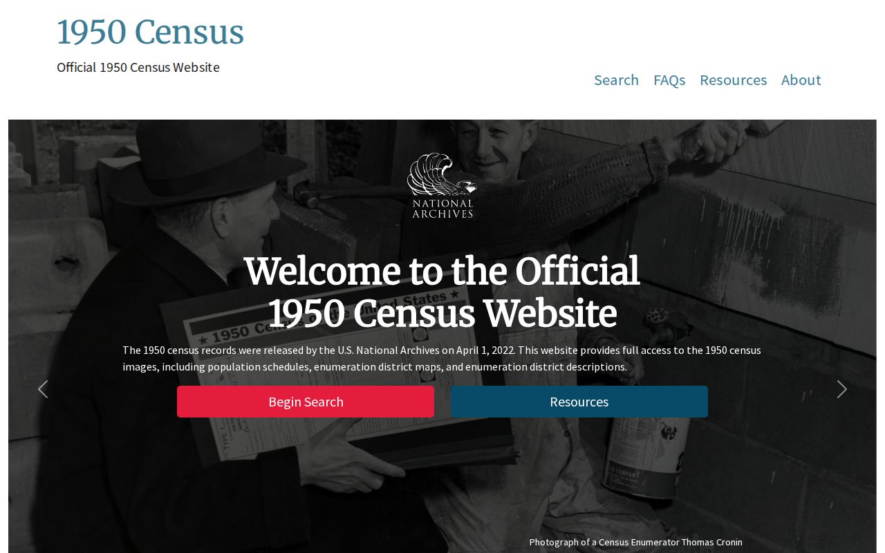
The census image shows how a federal household snapshot fits beside, rather than replaces, local directory and deed evidence.
Great Registers add another historical channel when a precinct can be identified. The California Room holds county volumes for 1867, 1879, 1880, 1884, 1890, and 1896, with microfilm from 1900 to 1944, plus San José volumes from 1946 through 1956. Registration proves a recorded civic status, not occupancy or ballot choice.
Santa Clara County Previous Residents and Maps
Sanborn fire-insurance maps do not name earlier occupants, but they can explain why an address search breaks. A map can show a building footprint, materials, use, lot shape, street number, and nearby structure in the edition year. That physical context helps match an old number to a current parcel or identify a subdivision change.
The Library of Congress Santa Clara County Sanborn collection is the remote starting point. Pair its map year with a directory issue, permit, deed, or newspaper. A map can show that a structure existed or changed; it cannot prove who occupied it.
Use the legal description when map and street data disagree. Tract and map references, lot and block, and recorded parcel changes are stronger links than a modern ZIP or a guessed house-number sequence.
[RESEARCH GAP: no successful manifest capture was available for the library house-history guide or a local criss-cross/Sanborn screen; the linked collections are the fallback.]
Santa Clara County Previous Residents: Archives
Permits date physical work, not occupancy. San José's public permit search accepts address, APN, permit or reference number, and tract. Applicant, property owner, architect, and contractor are different roles. For an incorporated parcel, use the city's planning or permit custodian; County Planning is the route for unincorporated land.
The County Archives online databases index probate, wills, naturalization, coroner inquests, maps, militia enrollment, professional registers, and other county-government records. The index points to physical material. An appointment is required, researchers may photograph when allowed, and Archives cannot issue certified copies. The repository map also directs researchers to History San José, De Anza College, Gilroy History Museum, New Almaden, SJSU, SCU, Stanford, and city historical collections.
Probate and obituary records can close an occupancy interval or explain a transfer. Search the Superior Court probate index and request the file from the clerk. Use the library's newspaper, clipping, microfilm, and obituary workflow for dates, then verify a legal event with the responsible custodian.
For an identifiable, nonexempt agency record, the California Public Records Act can support a focused request, but it does not require staff to create a dossier about an address. Give the custodian a date range, APN, document number, permit type, or other narrow identifier. The Recorder's known-document mail route and the Archives appointment route remain better fits for older property research.
Santa Clara County offices moved relevant Assessor and Clerk-Recorder service to 110 West Tasman Drive in 2025. The custodian did not change, but an old counter note or saved location may be stale. Confirm current service instructions before visiting.
Santa Clara County Previous Residents: Lawful History
Santa Clara County was created on February 18, 1850, and county record series begin from that jurisdictional point. Pre-1850 trails use mission, pueblo, Spanish or Mexican land-grant, and federal claim records. A missing online hit does not prove a missing record. Names, dates, bound volumes, access limits, and old geography can all hide a result.
The county research did not find an authoritative catastrophic courthouse fire that erased the foundational deed books. The safer conclusion is to check the Recorder counter, Digital Reel, book-and-page reference, California Room, Archives, or the responsible city office before declaring a gap.
Historic recorded documents can carry difficult social history, and recent county work has used machine-assisted review to identify racially restrictive language under California's AB 1466 process. Read the original instrument and any recorded modification as separate evidence, and do not treat historical language as an enforceable rule.
Lawful use. Santa Clara County past-resident research is for house history, family history, genealogy, and personal curiosity. Do not use a past name or address trail to stalk, harass, track, threaten, or intimidate a living person.
A careful trail ends with a source date, role, and confidence level. If the independent records do not agree, preserve the uncertainty and ask the custodian a narrow question instead of turning a partial clue into a present-day claim.